


Below is a link to a topo map of a WMA I plan to hunt with my buddy this fall. We are new to topo maps and were hoping to narrow our search field down when we go scouting in a couple of weeks. Could you help us narrow down some high percentage areas? And explain why so we can hopefully learn what we're looking for? Off the beaten path is fine and any help is appreciated.
http://fw.ky.gov/More/Documents/Taylors ... MA_ALL.pdf
Thanks
Topo Help
-
backstraps

- Moderator
- Posts: 10122
- Joined: Sun Jun 24, 2012 4:44 pm
- Location: Tennessee
- Status: Offline
Re: Topo Help
Welcome to the BEAST!
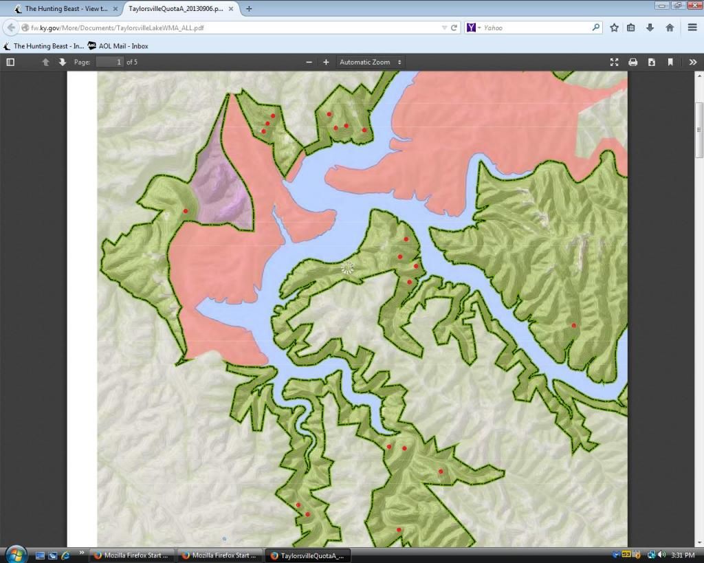
The map link you post is too general. If you could locate an area within the WMA you are interested in, zoom to the area, and post an aerial and topo, im sure you will get some insight and advice
The map link you post is too general. If you could locate an area within the WMA you are interested in, zoom to the area, and post an aerial and topo, im sure you will get some insight and advice
-
dan
- Site Owner
- Posts: 41642
- Joined: Sat Feb 13, 2010 6:11 am
- Facebook: https://www.facebook.com/HuntingBeast/?ref=bookmarks
- Location: S.E. Wisconsin
- Contact:
- Status: Offline
Re: Topo Help
I am assuming West and North being primary winds... The spots I pointed out are likey spots big bucks would bed on those winds if pressure is moderate. I would hunt the staging trails coming from these areas.
-
Clashire
- Posts: 6
- Joined: Mon Sep 16, 2013 1:48 pm
- Status: Offline
Re: Topo Help
The Beast himself replying to my post? I feel honored.
What makes you choose those areas based on the topo map? I'm pretty much a rookie at interpreting them for deer. I've pretty much only hunted our family farm and rely on spending time in the woods to know where the deer are.
Thanks.
What makes you choose those areas based on the topo map? I'm pretty much a rookie at interpreting them for deer. I've pretty much only hunted our family farm and rely on spending time in the woods to know where the deer are.
Thanks.
-
dan
- Site Owner
- Posts: 41642
- Joined: Sat Feb 13, 2010 6:11 am
- Facebook: https://www.facebook.com/HuntingBeast/?ref=bookmarks
- Location: S.E. Wisconsin
- Contact:
- Status: Offline
Re: Topo Help
Clashire wrote:The Beast himself replying to my post? I feel honored.
What makes you choose those areas based on the topo map? I'm pretty much a rookie at interpreting them for deer. I've pretty much only hunted our family farm and rely on spending time in the woods to know where the deer are.
Thanks.
The answer could get really detailed... I would suggest if your really interested in learning more about hunting in that type of terrain to get my DVD in the store called "Hill country bucks" not trying to make a sale, just letting you know that the DVD goes into great depth...
Bucks in hilly areas tend to bed on points along ridges. They bed with the wind blowing down the high land and over the point. At the same time there are thermals rising from the calm valley. There is a vacuum effect that pulls the thermals along the ground on the steep ridge. Thermals will rise on each side of the point. The buck will choose points that cover most common winds. IF the wind comes straight down the point he will bed on the tip of the point, if it angles one way or the other he will shift around the point. His bed will be right where the wind and the thermal collide causing what I like to call the thermal tunnel. This is where a bedded buck can smell both below and in front of him, or above and behind him... Its the safest place he could be.
-
- Advertisement
Who is online
Users browsing this forum: No registered users and 21 guests