


How do you guys get those little topo maps, and get them on the Beast?
I just can't seem to figure it out.
Here's where my place is.
http://www.anyplaceamerica.com/topograp ... 280-48798/
Maps
-
Spysar

- 500 Club
- Posts: 3974
- Joined: Sat Feb 20, 2010 11:23 pm
- Status: Offline
-
RaisedByWolves

- 500 Club
- Posts: 2441
- Joined: Tue May 18, 2010 12:49 pm
- Location: WI
- Status: Offline
Re: Maps
i use google earth with google topo.....there was a thread last summer where cornfedkiller showed us step by step how to get it all...its a free download.
When better is possible, good is never good enough
-
jlh42581

- 500 Club
- Posts: 2001
- Joined: Wed Jun 29, 2011 3:10 am
- Location: PA
- Contact:
- Status: Offline
Re: Maps
http://mytopo.com/search.cfm
follow it through like youre gonna buy a map. At the end it will let you preview it. Preview it, press CTRL+ALT+Print Screen. Open paint, press CTRL v, save it as a .jpg, upload it to photobucket, grab the [img] code below the image, paste it into the response
follow it through like youre gonna buy a map. At the end it will let you preview it. Preview it, press CTRL+ALT+Print Screen. Open paint, press CTRL v, save it as a .jpg, upload it to photobucket, grab the [img] code below the image, paste it into the response
-
JakeJD

- 500 Club
- Posts: 633
- Joined: Tue Nov 08, 2011 11:06 am
- Status: Offline
Re: Maps
If you are looking for Nebraska maps, you can download the actual USGS quad maps here:
http://snr.unl.edu/data/geographygis/di ... nloads.asp
Use this interactive map to determine which map you need:
http://maps.dnr.ne.gov/Quadrangles/default.aspx
PM me if you need some help, it would be easier to explain over the phone while you are at a computer.
http://snr.unl.edu/data/geographygis/di ... nloads.asp
Use this interactive map to determine which map you need:
http://maps.dnr.ne.gov/Quadrangles/default.aspx
PM me if you need some help, it would be easier to explain over the phone while you are at a computer.
"In the deed, the glory"
-
Spysar
- 500 Club
- Posts: 3974
- Joined: Sat Feb 20, 2010 11:23 pm
- Status: Offline
Re: Maps
Wow, thanks a lot. This is the first map I have been able to post. Hope I can figure out how to do it quicker now. 
Here's my place in NY. First the big pic, and then zoomed in. Lots of public land...
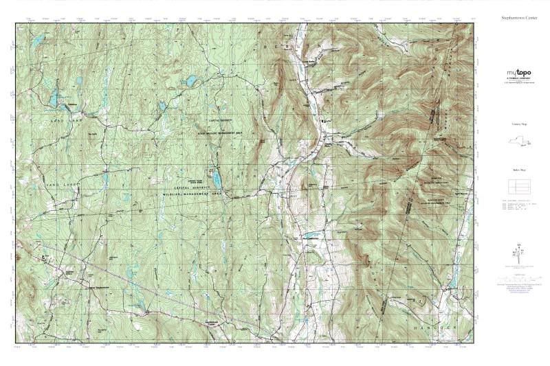
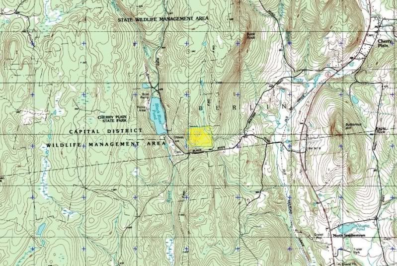
Here's my place in NY. First the big pic, and then zoomed in. Lots of public land...
A buck will see you three times, and hear you twice, but he's only gonna smell you once.

-
- Advertisement
Who is online
Users browsing this forum: No registered users and 19 guests