public land photo
- straitnarrow
- Posts: 213
- Joined: Tue Nov 15, 2011 1:14 am
- Location: east central MN
- Status: Offline
public land photo
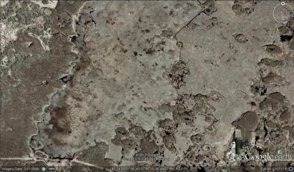
This is a chunk of some heavily pressured public land. Its roughly a mile and a quarter north to south and 2 miles east and west map. It's just under a mile or so from the north edge of the map to the nearest parking lot. North of this map gets alot of pressure from deer hunters, duck hunters, trappers, bird watchers, hikers etc.. There are alot of sod fields to the south west and a few to the south east. The public has some fields the dnr plant in when the feel like it to the north. Sometimes they plant other times they just let a corn field sit for a few years. I've never walked any of this mapped section. I plan on starting on transitions and looking for tracks and sign. Along with hunter sign, but if there is anything that stands out to anyone please speak up maybe it is something that I'm not seeing yet. I'm open for opinions tell me how you would hunt it and where you would start, what your going to be looking for and how you would go about it.
Bobby G
- BigHunt
- Posts: 12160
- Joined: Mon Jun 20, 2011 9:50 am
- Location: Wisconsin
- Status: Offline
- straitnarrow
- Posts: 213
- Joined: Tue Nov 15, 2011 1:14 am
- Location: east central MN
- Status: Offline
Re: public land photo
Nope this is what is on google earth. The west side is mainly timber and the majority of the map is marsh.
Bobby G
- BigHunt
- Posts: 12160
- Joined: Mon Jun 20, 2011 9:50 am
- Location: Wisconsin
- Status: Offline
Re: public land photo
well there is some obivious trasnsition lines on the map .....i would conintrate on that first ....this is wear ive been finding most of my beds.....then i would walk around those islands next they like to bed off the tips of them in the cattails
HUNT LIKE A BEAST
- straitnarrow
- Posts: 213
- Joined: Tue Nov 15, 2011 1:14 am
- Location: east central MN
- Status: Offline
Re: public land photo
Thats the plan here this weekend....girlfriend approval pending....There is a walking path that splits the map that starts all the way back at the parking lots but I've noticed most people turn around a half mile to three quarter from the parking lot but I have found some duck hunters and a few bow hunters in some spots just north of the map edge. The south side of the map all butts up to public land so that I have going for me that should keep a handful of people out of this section of the marsh. Thanks for the input bighunt!
Bobby G
- BigHunt
- Posts: 12160
- Joined: Mon Jun 20, 2011 9:50 am
- Location: Wisconsin
- Status: Offline
Re: public land photo
straitnarrow wrote:Thats the plan here this weekend....girlfriend approval pending....There is a walking path that splits the map that starts all the way back at the parking lots but I've noticed most people turn around a half mile to three quarter from the parking lot but I have found some duck hunters and a few bow hunters in some spots just north of the map edge. The south side of the map all butts up to public land so that I have going for me that should keep a handful of people out of this section of the marsh. Thanks for the input bighunt!
good luck!!!!....post pics
HUNT LIKE A BEAST
-
- Advertisement
Who is online
Users browsing this forum: No registered users and 6 guests